Memory Colorspace
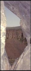
 Hole in the wall, Key to the land beyond.
Or the space beyond as the case may be. There’s a wall of rock, then a mile of air, then the cliff on the other side. The crack of cool shade in the late afternoon sun. As hot and dry as the dusty rock is outside, it’s always cool in the crack.
This picture looks out from a little path that disappears into the face of the cliff at Sun Wall, at Vantage. Approaching the edge, it looks like there’s no easy way down. Then there’s a narrow path leading behind the first row of basalt columns. It gets far enough down that you’re at mid-height of the cliff, along the top of the talus slope. The talus slope has enough of a stable top that you can get to climbing spots. But not so much that you mistake this for stable rock. This is definately one of those places where the ground isn’t quite as permanent as it might appear.
The terrain around here was shaped by cataclysmic events. Columbia river basalt flows; volcanic rock in hundred foot thick layers. I think that there are three layers represented in this ampitheatre. The columns were formed by cracks that formed as the whole mass cooled. Kind of like what happens to drying mud. The Coulees in the area were carved in the great flood; when lake Missoula broke its ice dam and drained a great lake sized volume of water in a week. A flood so big that they didn’t quite realize it till satelite imaging put the pieces together. Compared to that ice dam, the Grand Coulee dam is a child’s toy.
And now the terrain is an irrigated desert. Power is taken from the river, and shipped off to industry. Water is taken from the river and dumped on the desert to grow wheat and potatoes. It’s amasing that there’s a river left for the salmon.
No comments
